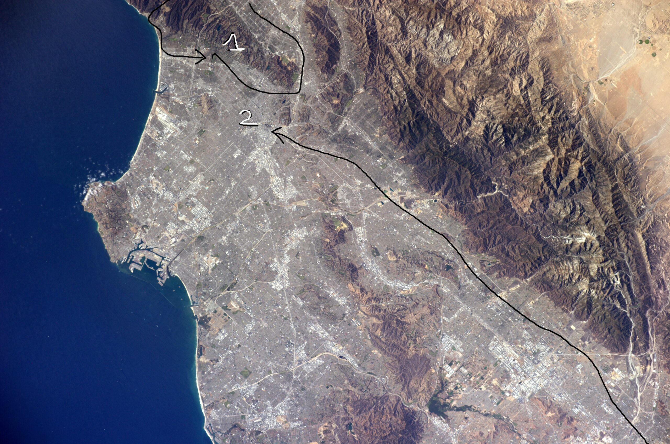
I narrowed down my walking tour to two routes:

The first choice is a loop around the Santa Monica Mountains. Starting in Hollywood, I walk to Downtown LA passing through Griffith Park, follow the Los Angeles River upstream, go west across the San Fernando Valley, cross the mountains through Topanga State Park, down to the Santa Monica Pier, and back along Santa Monica Boulevard to Hollywood. This one has a great variety of scenery, famous sights, dramatic views of ocean and city, while still sampling the suburban sprawl of LA.
The second one is a straight cut, a transect, along the longest line of continuous city I could find on the map, from San Bernardino to Santa Monica, keeping the San Gabriel Mountains to my right, through Downtown LA and many suburban cities I’ve never heard of. It also has almost nothing natural along the way, and pretty much nothing famous.
I did a little searching online to see if anyone had did anything similar and shared the tale. I found the Great LA Walk, which happens every year in November, a great one day event. I found the Big Parade, a two day event involving some camping that apparently hasn’t happened in a few years. I found the Inman 300, a “urban through hike” of many scenic parts of the city, and a far great accomplishment than what I’m doing.
But I didn’t find anything like going for a multiday walk through the least scenic parts.
I don’t know anyone in Southern California, so I did what any millennial does: I asked reddit, the self proclaimed front page of the internet.
The folks in the communities of r/askLosAngeles and r/socalhiking gave me invaluable advice. Nearly everyone said the first option would be far superior as a hike: it would be more scenic, shadier, and further away from heavy traffic. But everyone telling me to avoid the second made me ponder the places we live in, and why some are more desirable than others.
Because I clearly have too much time on my hands, I looked up census data on the areas I’d be walking. A site called bestneighborhood.com brings together census tract data and overlays it on a map with color code, which is very handy.


From here it’s plain that route 2, despite being far less scenic, is a better sample of the area. I’m far more likely to encounter an “average” Californian. It’s a walk that will give me a good idea of what life’s like here for more people, compared to the route 1, and to me, that’s what makes a good city visit.
Later on, I found out that I’m tracing the Old Spanish Trail, which is a whole story unto itself. The trail itself has been lost, though, so I’m not following the best guess route too closely. I’ll be entirely on concrete sidewalks.

The number one concern will be the heat. Even without the heat wave currently upon the Southland, I’ll be in the sun a lot. Tree cover in a neighborhood correlates with income–richer areas are noticeably leafier and greener. I need a big hat and plenty of water.
Planning it out took a few days: I needed to look for motels (hostels in this area are non-existent), see where I could take breaks from the sun (public libraries are the best; I can also do malls, since I’ll be dressed nicely enough to look like a paying customer), and where there are sidewalks at all. Street view is amazing for this.
Here we are on Friday, October 4th, and I’m about to get on the plane to LAX.
My pack looks like this:

At center-left you’ll see a book of maps. This is the Thomas Guide, a 500 page beast of an atlas covering all the streets of Los Angeles and Orange counties. Well worth the weight, in my opinion, if only for the absurdity. I have the clothes on my back too, a pair of sandals, and a cheapo smartphone. I’ll also accumulate some more clothes, too: a shirt from the running race, and a wide hat at some point.
In the end, I decided to aim for the Pueblo of Los Angeles instead of Santa Monica. It’s too hot right now.
Starting Monday, I have 58 miles (93 km) to cover in four days, but who’s counting? See you on the trail.

Leave a Reply